
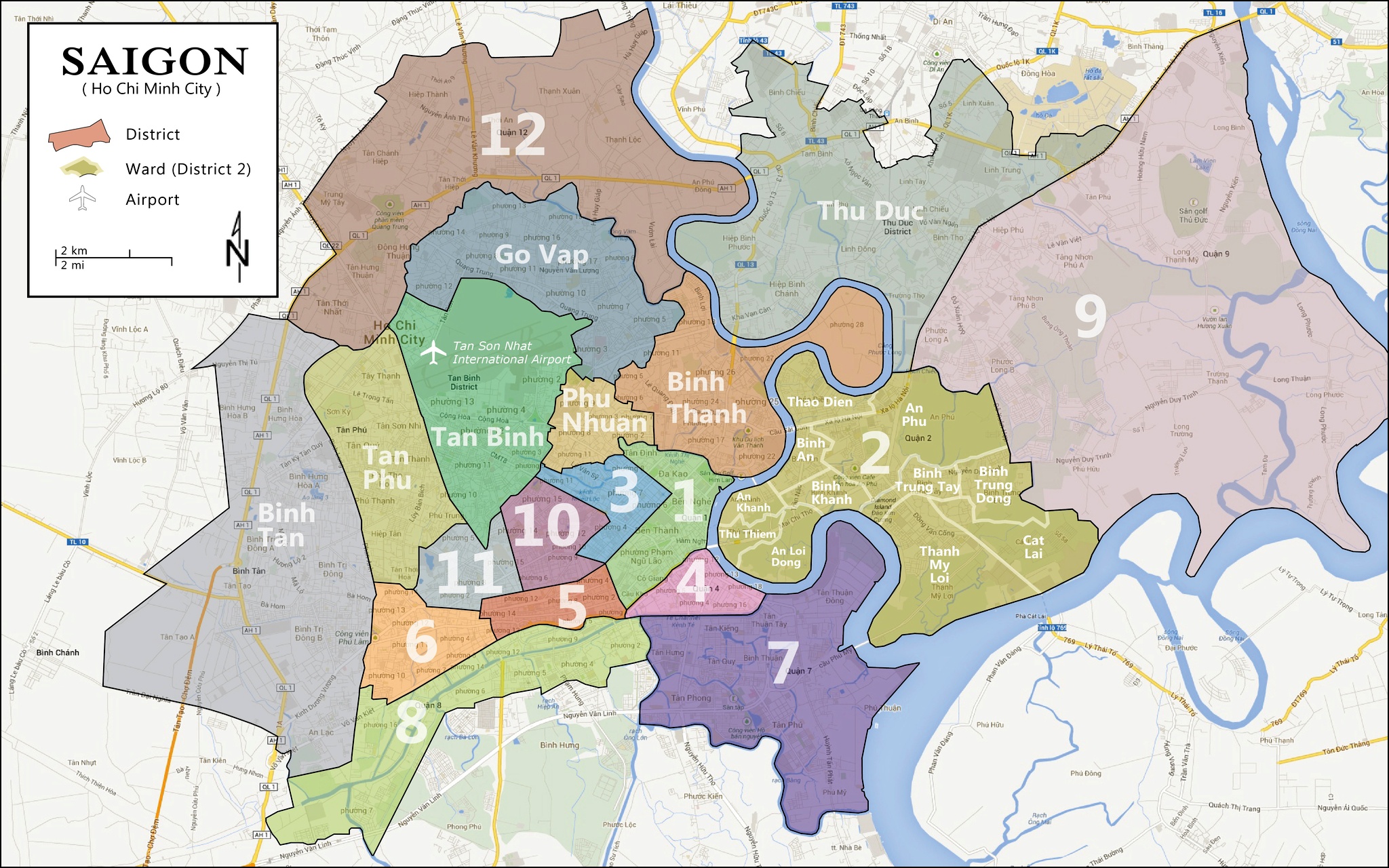
After scouring the internet for a good map of Ho Chi Min City, Vietnam (also known as Saigon), I decided to make one myself. This is a political map showing select districts within the city. The main issue with other maps is that they don’t clearly show all of the main districts in the core of the city. I remedied this by omitting large parts of the city, which are primarily used for farmland, while still maintaining a relatively small (i.e. zoomed-out) scale. This map can be used when searching for housing, planning a trip, or simply navigating through Ho Chi Minh City. I used spatial data from Google Maps to form the polygons used in this map. District 2 is further subdivided into wards, as some realtors refer a property’s ward when describing its location in this district.
